BERKELEY SCHOOL OF BUSINESS, ARTS & SCIENCES

Autodesk Certified Professional in Civil 3D for Infrastructure Design

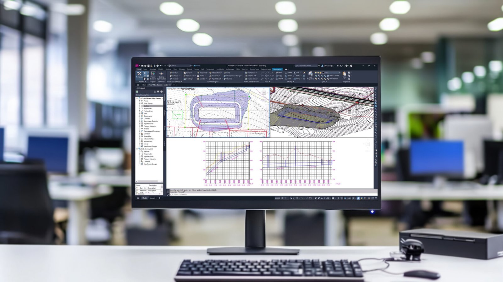
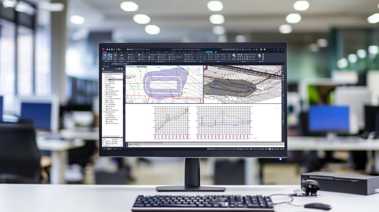
The Civil 3D for Infrastructure Design certification validates advanced skills in Autodesk Civil 3D and standard infrastructure design workflows. Moreover, it demonstrates expertise in alignments, profiles, surfaces, grading, corridors, pipe and pressure networks, survey data, and project collaboration. Furthermore, earning this certification helps professionals demonstrate advanced technical capabilities and strengthen their position in the competitive civil engineering and infrastructure design industry. 

Civil 3D for Infrastructure Design

Overview

Civil 3D for Infrastructure Design

The Civil 3D for Infrastructure Design certification validates advanced Autodesk Civil 3D skills for professionals working on infrastructure projects. Moreover, it demonstrates the ability to apply efficient workflows for developing accurate civil engineering designs. Furthermore, candidates are expected to understand alignments, profiles, surfaces, grading, corridors, and related infrastructure elements. In addition, the certification covers pipe and pressure networks, survey data, and project collaboration workflows. Consequently, professionals can demonstrate their ability to manage complex infrastructure design requirements using Civil 3D. Furthermore, the certification emphasizes practical application rather than basic software familiarity alone. In addition, it helps candidates demonstrate technical competence in planning, designing, documenting, and coordinating infrastructure projects. Therefore, earning this credential can strengthen professional credibility among employers and clients in civil engineering and infrastructure development. Moreover, it can support career advancement into specialized civil design and infrastructure engineering roles. Finally, the certification provides a valuable professional benchmark for individuals seeking to demonstrate advanced Civil 3D expertise.

Certification DetailInformation
Certification NameAutodesk Certified Professional in Civil 3D for Infrastructure Design
Focus AreaCivil 3D for Infrastructure Design
SoftwareAutodesk Civil 3D
Certification LevelProfessional
Primary FocusInfrastructure design and civil engineering workflows
Key SkillsAlignments, profiles, surfaces, grading, corridors, pipe networks, pressure networks, survey data, and collaboration
Design ApplicationsRoads, land development, utilities, grading, and infrastructure projects
Professional LevelAdvanced
Target ProfessionalsCivil engineers, infrastructure designers, CAD professionals, and civil design specialists
Career AreasCivil engineering, infrastructure design, transportation, land development, and construction
Credential BenefitDemonstrates advanced Autodesk Civil 3D expertise

Official Autodesk Certification Page

Offered By

Head office

San Francisco, California, United States

Members

Autodesk serves a global community of designers, engineers, architects, manufacturers, construction professionals, and media and entertainment professionals who use Autodesk software and technologies.

Vision & Mission

The vision of the Civil 3D for Infrastructure Design certification is to develop advanced civil engineering professionals who can use Autodesk Civil 3D to create accurate, efficient, and coordinated infrastructure designs. Moreover, it promotes technical excellence, digital engineering practices, design accuracy, and efficient project workflows. Its mission, therefore, is to validate advanced competencies in alignments, profiles, surfaces, grading, corridors, pipe and pressure networks, survey data, and infrastructure project collaboration. Furthermore, the certification helps professionals demonstrate industry-relevant expertise, strengthen professional credibility, and advance their careers in civil engineering, infrastructure design, transportation, land development, and construction.

What is the Eligibility?

  • No specific academic degree or formal educational qualification is stated by Autodesk.
  • Candidates should have approximately 400–1,200 hours of real-world Civil 3D software experience.
  • Candidates should have advanced skills in Autodesk Civil 3D.
  • A general understanding of standard Civil 3D workflows, processes, and project objectives is recommended.
  • Candidates should understand alignments, profiles, and sections.
  • Knowledge of surfaces and grading is required.
  • Familiarity with pipe and pressure networks is recommended.
  • Candidates should understand data management and collaboration workflows.
  • Knowledge of points, parcels, and survey data is expected.
  • Candidates should be familiar with corridor design.
  • Therefore, substantial practical Civil 3D experience is strongly recommended before attempting the professional certification exam.

Who can do?

Civil 3D for Infrastructure Design
anyone who is interested to learn about following concepts can pursue Autodesk Certified Professional in Civil 3D for Infrastructure Design:
Civil 3D for Infrastructure Design, Autodesk Civil 3D, Civil Engineering Design, Infrastructure Design, Road Design, Corridor Design, Surface Modeling, Grading Design, Pipe Networks, Pressure Networks, Survey Data, Land Development.
individuals with the following designations:
Civil Engineer, Civil Design Engineer, Infrastructure Engineer, Civil 3D Designer, CAD Designer, Infrastructure Design Engineer, Transportation Engineer, Highway Design Engineer, Land Development Engineer, Civil CAD Technician, BIM Engineer, Civil Engineering Specialist, Infrastructure Consultant.

Course Structure

Module 1: Instructional Methodology

The course is delivered through structured learning formats combining civil engineering theory with practical Civil 3D workflows for infrastructure design.
 

Included

Lessons covering Civil 3D fundamentals

Included

Guided practice exercises for infrastructure projects

Included

Challenge assignments based on real-world scenarios

Included

Continuous assessments for performance evaluation

Included

Practice exam aligned with professional certification

Module 2: Civil 3D Interface and Project Setup

Understanding the Civil 3D interface and setting up infrastructure design projects efficiently.
 

Included

Workspace customization and toolspace navigation

Included

Project setup and templates

Included

Data shortcuts and file management

Included

Survey data import and management

Module 3: Surface Modeling and Terrain Analysis

Creating and analyzing surfaces to represent terrain and support infrastructure design decisions.
 

Included

Surface creation and editing

Included

Contours and elevation analysis

Included

Breaklines and boundaries

Included

Volume calculations

Module 4: Alignment and Profile Design

Designing horizontal and vertical alignments for roads and infrastructure projects.
 

Included

Alignment creation and editing

Included

Profile generation and modification

Included

Design criteria and standards

Included

Labeling and annotation

Module 5: Corridor Modeling

Developing corridor models for road and infrastructure design using assemblies and subassemblies.
 

Included

Assembly creation and management

Included

Corridor setup and configuration

Included

Target mapping and optimization

Included

Corridor surface generation

Module 6: Grading and Site Design

Applying grading tools and site design techniques for land development projects.
 

Included

Grading creation and editing

Included

Feature lines and parcels

Included

Site balancing and earthwork

Included

Volume analysis

Module 7: Pipe Networks and Utility Design

Designing and managing pipe networks for drainage and utility infrastructure systems.
 

Included

Pipe network creation and editing

Included

Structure and pipe configuration

Included

Hydraulic analysis basics

Included

Network labeling and documentation

Module 8: Documentation and Plan Production

Producing construction-ready drawings and documentation from Civil 3D models.
 

Included

Plan and profile sheets

Included

Section views and layouts

Included

Annotation and labeling standards

Included

Plotting and publishing

Module 9: Final Certification Exam

A proctored professional-level certification exam assessing Civil 3D infrastructure design skills without software access.
 

Included

Multiple-choice questions

Included

Drag-and-drop object association

Included

Active-screen interface questions

Included

Hot-area graphical selection

Included

Graphic interpretation scenarios

Lecture Plan

Learning Methodology

Berkeley offers expertly developed learning materials tailored to meet participants' needs, ensuring comprehensive coverage of the syllabus and optimal exam preparation.

‣ Tailored Material: Guides are designed to cover the entire syllabus, offering full preparation and deep understanding.

‣ In-Depth Content: Unlike superficial outlines, our materials provide fully developed theories and concepts, equipping participants with complete knowledge.

‣ Strategic Study: We help participants prioritize study time by indicating the weight of each topic, allowing efficient focus on crucial areas.

‣ Difficulty Levels: Topics are labeled as "Awareness" or "Proficiency," guiding participants to allocate time based on the required depth of knowledge.

‣ Comprehensive Coverage: Our materials include detailed theory and a glossary of technical terms to clarify complex concepts.

‣ Effective Learning Techniques: Visual aids and memorization techniques ensure long-lasting retention, helping candidates succeed.

Berkeley’s methodologies equip participants with the essential knowledge and tools for both exams and future success.

Civil 3D for Infrastructure Design
Lectures

Our lecture plan integrates structured learning with interactive teaching methods, promoting engagement and collaboration. This approach ensures a comprehensive understanding of concepts, fostering critical thinking and practical application in real-world scenarios.

Civil 3D for Infrastructure Design
Practice Session

Practice sessions offer hands-on experience through guided exercises, enhancing skills and reinforcing knowledge. This practical approach ensures mastery of concepts, promoting.

Civil 3D for Infrastructure Design
Mock Examination

Mock examinations simulate real test conditions, providing valuable practice and assessment. This helps identify strengths and weaknesses, ensuring thorough preparation and boosting confidence for actual exams.

Berkeley's performance standards

Evaluates and ensure the quality of the training program and all its deliverables. This is measured through the following indicators:
‣ Instructors' experience and style in presenting and explaining topics.
‣ Variety and balance of teaching methods (such as discussions, case studies, mock exams, and videos) used in the course to ensure retention and to match the learning objectives.
‣ Level of interactivity.
‣ Feedback from program participants.
‣ Full compliance with Institute standards and guidelines for preparation and study requirements and methodology.
‣ Progress reports from the training program provider.

What are the Exam Information?

Civil 3D for Infrastructure Design

The Autodesk Certified Professional in Civil 3D for Infrastructure Design exam evaluates advanced knowledge of Autodesk Civil 3D and infrastructure design workflows. Moreover, candidates are assessed on alignments, profiles, surfaces, grading, corridors, pipe and pressure networks, survey data, data management, and project collaboration. Furthermore, the exam measures the ability to apply Civil 3D tools and workflows effectively to real-world infrastructure design projects. Official Autodesk Certification Page

Exam Format & Duration
  • Exam Format: Selected-response questions
  • Question Types: Multiple-choice, drag-and-drop, active-screen, hot-area, and graphic-interpretation questions
  • Number of Questions: 45–60
  • Duration: 120 minutes
  • Exam Language: English
  • Software Access: Candidates do not have access to Civil 3D during the exam
  • Testing Options: Pearson Testing Center or online through Pearson OnVUE
  • Result: Pass or Fail
  • Certification Validity: 3 years
  • Standard Exam Price: US$200 

Official Autodesk Certification Page

Part/Module Exam Format Exam Duration
Module 1: Instructional Methodology

Internal assessments including practical design tasks and multiple-choice questions.


Ongoing assessments with a final practice exam of 60 minutes

Module 2: Civil 3D Interface and Project Setup

Multiple-choice questions with interface-based tasks.


50 minutes

Module 3: Surface Modeling and Terrain Analysis

Practical surface modeling tasks with MCQs.


60 minutes

Module 4: Alignment and Profile Design

Hands-on alignment and profile design tasks with MCQs.


60 minutes

Module 5: Corridor Modeling

Corridor modeling tasks with multiple-choice questions.


75 minutes

Module 6: Grading and Site Design

Practical grading and site design assessment with MCQs.


60 minutes

Module 7: Pipe Networks and Utility Design

Utility design tasks with multiple-choice questions.


60 minutes

Module 8: Documentation and Plan Production

Documentation and drawing production tasks with MCQs.


50 minutes

Module 9: Final Certification Exam

Selected-response exam including multiple-choice, drag-and-drop, active-screen, hot-area, and graphic-interpretation questions.


120 minutes (45–60 questions)

Exam Dates

The Autodesk Certified Professional in Civil 3D for Infrastructure Design exam does not have fixed annual exam dates. Instead, candidates can schedule an appointment based on available dates and times through their Autodesk Account and Pearson VUE.

  • Exam Dates: Available throughout the year, subject to appointment availability
  • Registration: Through an Autodesk Account
  • Scheduling: Candidate selects the available date and time
  • Testing Options: Pearson Testing Center or online through Pearson OnVUE
  • Date & Time: Confirmed during the Pearson VUE scheduling process
  • Rescheduling: Available through the Autodesk Account, subject to applicable policies

Autodesk specifically states that candidates use their Autodesk Account to schedule or reschedule exam appointments.

Official Autodesk Certification Page 

Exam Registration Deadline

There is no fixed annual registration deadline for the Autodesk Certified Professional in Civil 3D for Infrastructure Design exam. Instead, candidates submit their certification application and schedule an available appointment through their Autodesk Account and Pearson VUE.

  • Registration: Available throughout the year
  • Fixed Deadline: None specified by Autodesk
  • Scheduling: Subject to available Pearson VUE appointments
  • Testing Options: Pearson Testing Center or Pearson OnVUE
  • Cancellation/Rescheduling: Must be completed at least 24 hours before the scheduled appointment. 
  • Exam Voucher: If using a voucher, the exam must be registered for and taken before the voucher's stated expiration date. 

Official Autodesk Certification Page

Passing Criteria
  • Passing Score: Autodesk does not publicly disclose a fixed passing score for the Civil 3D for Infrastructure Design exam.
  • Assessment: Candidates must demonstrate sufficient competency across the assessed Civil 3D infrastructure design skills.
  • Result: The exam is reported as Pass or Fail.
  • Scoring: The passing standard may vary according to the examination.
  • Retake: Candidates who do not pass can follow Autodesk’s applicable retake policy.
  • Credential: Successful candidates earn the Autodesk Certified Professional in Civil 3D for Infrastructure Design credential.

Official Autodesk Certification Page

Exam Locations

The Autodesk Certified Professional in Civil 3D for Infrastructure Design exam is available through two testing options:

  • Pearson Testing Centers: Candidates can take the exam in person at an available Pearson Testing Center.
  • Pearson OnVUE: Candidates can take the exam online with remote proctoring from a suitable testing environment.
  • International Availability: Testing center availability varies by country and location.
  • Exam Scheduling: Candidates use their Autodesk Account to schedule or reschedule an exam appointment.
  • Online Testing: Candidates choosing OnVUE must meet Autodesk's system and proctoring requirements. 

Official Autodesk Certification Page

Civil 3D for Infrastructure Design

Success Stories

“As a strong advocate for education and human development, I commend Berkeley for its exceptional commitment to empowering future leaders. The institution stands as a symbol of excellence, innovation, and opportunity. Students who walk its halls are nurtured with knowledge, values, and vision—qualities that contribute to building a stronger and more prosperous future for our nation.”- H.H. Shaikh Khalifa Al Hamid

Visit our Alumni

Alumni Benefits

‣ Exclusive Networking Events: Access invitations to industry-leading events and thought-leadership gatherings featuring renowned speakers.


‣ Monthly Updates: Stay informed with a newsletter highlighting the latest research, events, and activities from the school.


‣ LinkedIn Community Access: Join the Executive Education LinkedIn group for networking and professional development opportunities.


‣ Educational Discounts: Enjoy a 20% discount on open-enrollment programs and access to workshops focused on emerging trends.


‣ Global Alumni Network: Connect with a diverse alumni community through the Berkeley School’s online network and engage in country and interest groups.

Is It Worth the Investment?

The Autodesk Certified Professional in Civil 3D for Infrastructure Design validates advanced skills in Autodesk Civil 3D, infrastructure design, alignments, profiles, surfaces, grading, corridors, pipe and pressure networks, survey data, and project collaboration. Moreover, it strengthens professional credibility and supports career progression into roles such as Civil Engineer, Civil 3D Designer, Infrastructure Engineer, Civil Design Engineer, Transportation Engineer, Highway Design Engineer, and Land Development Engineer.

Potential Career Earnings After Certification:

  • UK: £40,000–£75,000+ per year
  • Middle East: AED 150,000–320,000+ per year
  • USA: USD 70,000–125,000+ per year
  • Asia & Africa: Competitive salaries depending on role, qualifications, experience, and location.

Civil 3D for Infrastructure Design

Progression Route:

The Civil 3D for Infrastructure Design certification provides an advanced foundation in civil engineering and infrastructure design workflows. After completing it, professionals can deepen their expertise in Autodesk Civil 3D and pursue advanced Autodesk Certification pathways. Furthermore, they can progress into roles such as Civil 3D Designer, Civil Design Engineer, Infrastructure Engineer, Transportation Engineer, Highway Design Engineer, or Land Development Engineer. With additional project experience and professional development, candidates can advance into Senior Civil Engineer, Infrastructure Design Manager, BIM Manager, or Civil Engineering Consultant positions. Learners can also explore the Civil 3D for Infrastructure Design course, Autodesk Certified Professional in BIM Management for Building Design, Autodesk Certified Professional in Revit for Architectural Design and Autodesk Certified Professional in Revit for Structural Design for continued professional development.

What You Earn

You will get a certificate of completion, which is highly reputed and accepted by employers

Civil 3D for Infrastructure Design

Future Trends

Growing demand for BIM-based infrastructure design, digital workflows, and smart civil engineering solutions.

Fundamental Knowledge

Covers core skills in alignments, corridors, surfaces, grading, and infrastructure modeling workflows.

Technical Skills

Demonstrates expertise in Autodesk Civil 3D tools for infrastructure layout, design documentation, and project coordination.

Related courses

Autodesk Certified Professional in BIM Management for Building Design

The Professional in BIM Management for Building Design focuses on advanced BIM project planning, standards, execution plans, multidisciplinary coordination, Common Data Environments (CDEs), model management, quality control, and project closeout. Moreover, it helps professionals manage coordinated, compliant, and efficient BIM workflows across the project lifecycle. 

Read More
Autodesk Certified Professional in Revit for Architectural Design

The Professional in Revit for Architectural Design certification validates advanced Revit skills for professional architectural workflows. Moreover, it demonstrates expertise in modeling, documentation, collaboration and coordination, project standards, families, and information analysis. Furthermore, the certification helps professionals showcase industry-relevant skills, strengthen their credibility, and stand out in a competitive job market.

Official Autodesk Certification Page

Read More
Autodesk Certified Professional in Revit for Structural Design

The Professional in Revit for Structural Design certification validates advanced skills in Autodesk Revit for structural design and BIM workflows. Moreover, it demonstrates expertise in structural modeling, analytical models, structural components, families, views, documentation, and project coordination. Furthermore, the certification helps professionals validate industry-relevant Revit skills and strengthen their credibility in structural engineering and BIM careers. Autodesk Revit for Structural Design Certification

Read More

FAQ: Autodesk Certified Professional in Civil 3D for Infrastructure Design

Contact Us 

Cart

Cart (0)